Case Study 2026-06-04

How We Mapped a 4,500-Hectare Forest in Just 7 Days! 🌲🚁

Jacob Hjalmarsson 4 June, 2025

Ever looked at a huge forest and thought, "Where do we even begin?" That's exactly the problem a major Nordic forestry company faced with a massive 4,500-hectare property. They needed a complete inventory, and the old way just wasn't going to cut it.

The BIG Problem 😟

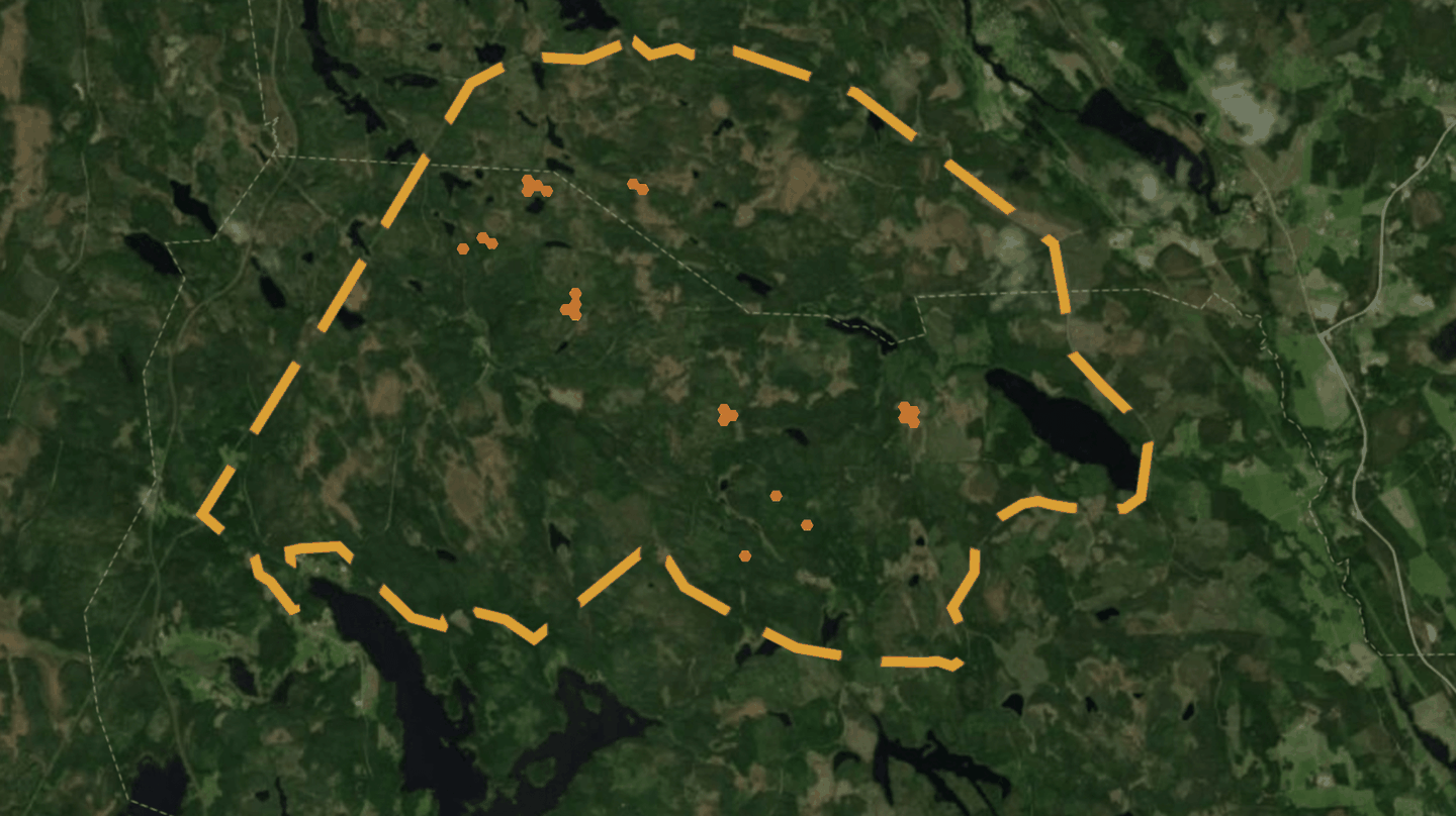
Doing a traditional, on-the-ground inventory was, in the words of the manager, "impossible to carry out."

  • The Area was HUGE: We're talking 4,500 hectares of dense forest.
  • Time was Money: A manual survey would have taken months and cost a fortune.
  • Urgent Need: They needed to find damaged areas and plan harvesting operations quickly.

Arboair to the Rescue! πŸš€

Instead of months of walking, they got it done in just seven flight days. Here’s how they did it:

  • Drone Power: They flew with easy to fly consumer drones over the entire area, capturing incredibly detailed images.
  • AI Analysis: Our smart AI platform analyzed everything, identifying damages on individual trees (bark beetle damages, tip broken trees and windfallen trees), checking their health, and pinpointing damaged areas with precision. πŸ€–
  • Actionable Data: We delivered a complete digital map with semi-automated harvesting plans. The best part? The data was sent straight to the harvesters in the forest!

The Results! πŸŽ‰

This wasn't just about speed; it was about unlocking real value.

  • βœ… Found Hidden Timber: Our analysis uncovered an extra 20,000 cubic meters of valuable timber!
  • 🎯 Pinpointed Damage: We located approximately 300 damaged areas, making it easy to plan cleanup and salvage wood.
  • ⏱️ Saved Time & Money: We massively cut down the time and cost compared to traditional methods.
  • 🀝 Streamlined Operations: With data sent directly to the machines, the whole harvesting process became much smoother.

As the manager at the company put it, "With the help of the analysis, we could efficiently locate damaged forest... The measured points with damages could be sent directly to the harvester and correlated well with the geographical position of the damages.”

It’s all about working smarter, not harder. With the right data, you can completely transform your forest management.

Curious how Arboair can help you see your forest in a new light? Let’s chat!