
More efficient encroachment valuation through digital timber valuation
When power lines, railways or roads are routed through forest land, precise and objective documentation is needed to value the forest affected. Arboair's AI analyses every individual tree and delivers a documented decision basis – fast and without room for interpretation.
Subjective field assessments replaced by measurement data
Traditional manual valuation is time- and resource-intensive. Different consultants can reach different assessments of the same stand, leading to disputes and delayed processes.
Arboair's method replaces subjective field assessments with AI analysis based on image data – replicable, documented and legally traceable.
Delivery per tree
Individual tree-level data – the entire corridor at once
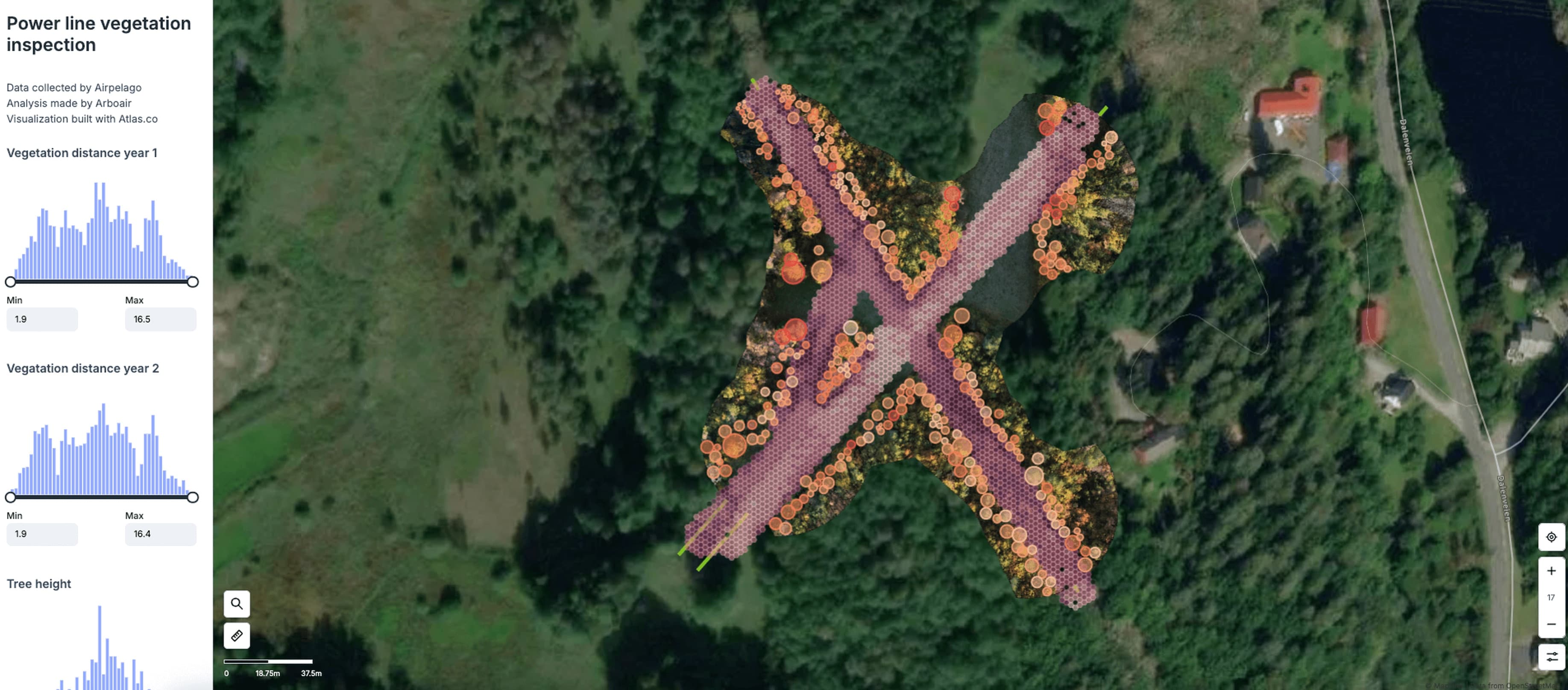
Arboair analyses every individual tree within the affected area and delivers complete data for the encroachment valuation.
Tree species
Automatic species identification per tree – pine, spruce and deciduous with documented accuracy.
Volume (m³fub)
Volume calculation per tree and aggregated per stand – directly usable in valuation models.
Stem diameter (DBH)
Mean absolute error ±2.64 cm without calibration. Below 2 cm with field calibration.
Height & crown diameter
Per tree, with geo-referenced position – enabling GIS integration and mapping of the affected corridor.
±2 cm
Mean absolute error on individual tree stem diameter
−3.34%
Average volume deviation vs. harvester data
100%
Of tested sites within ±20% of actual harvester data
For those who need the right figure – not an estimate
“We need documentation that holds up if a landowner questions the valuation. With tree-specific AI analysis we get documented volume figures per stand, not an estimate.”
Land negotiator
Power grid company
“Valuing forest land along a road corridor manually takes weeks. We can see that with this technology we can analyse the entire corridor early in the project, before negotiations with landowners have even started.”
Land negotiator
Swedish Transport Administration
“When the grid company came with their documentation I knew straight away it was serious. Every tree on my land was digitally documented – species, volume, value. It felt reassuring to negotiate from the same numbers.”
Landowner
Property owner
How it works
From defined corridor to finished valuation documentation
- 1
Data collection
Image data is captured over the affected corridor by drone or aircraft. Arboair can handle the entire capture.
- 2
AI analysis per tree
Arboair's AI models analyse every individual tree and calculate species, height, stem diameter, crown diameter and volume.
- 3
Delivery of data
Results are delivered as complete stand documentation – exportable to GIS systems, Excel or directly into your valuation model.
- 4
Documented and traceable
The documentation is replicable and method-documented – ready to use in negotiations, permit processes or court.
Need documentation that holds up?
Contact us to discuss your corridor and what delivery time we can meet.