
The 3-30-300 rule: A data-driven strategy for greener and healthier cities
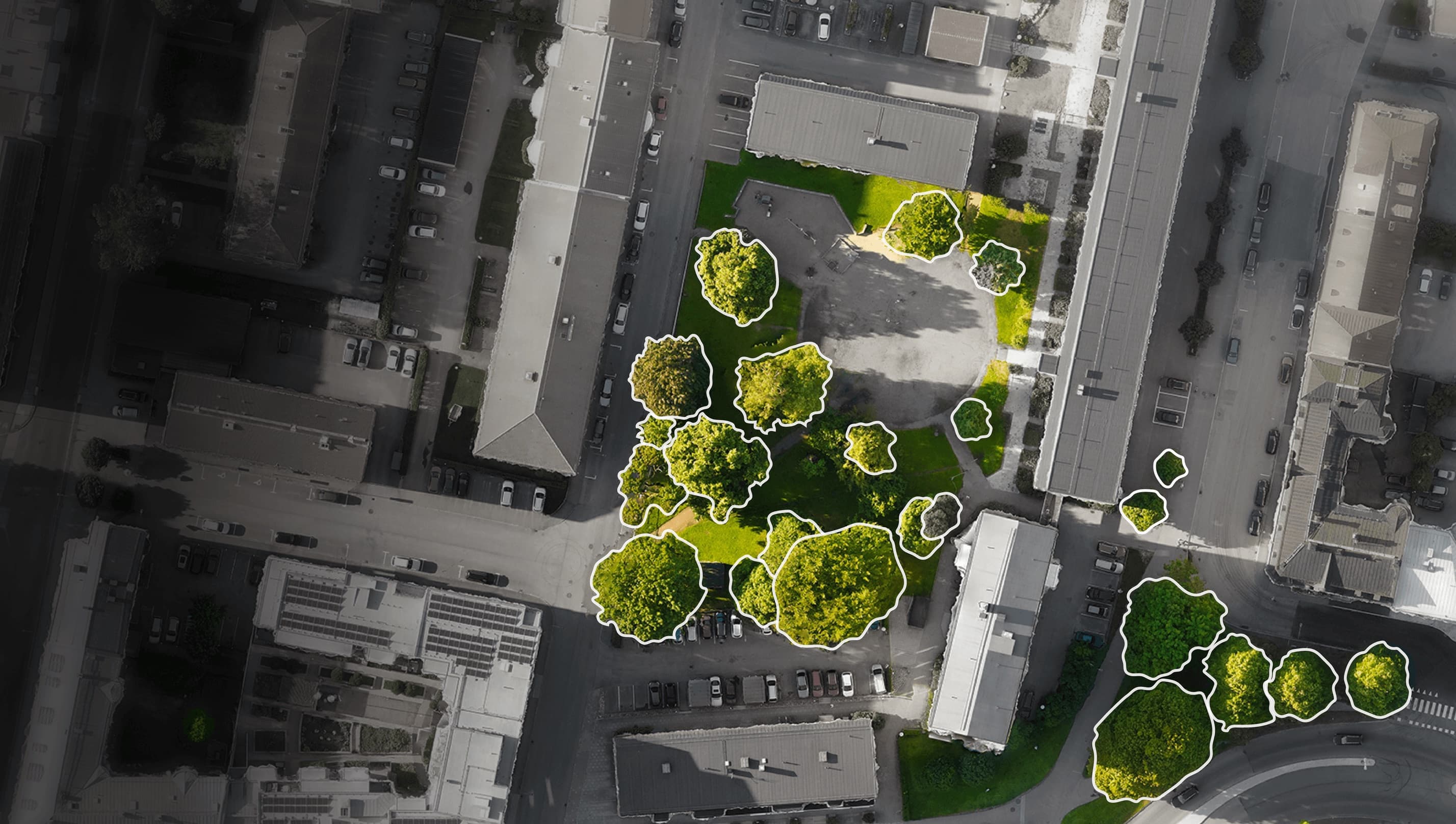
The 3-30-300 rule has been developed from extensive research into the positive effects of urban trees on health and well-being, and sets three clear, measurable targets for urban greenery:
- 3 trees from every home: This principle advocates that every resident should be able to see at least three trees from their home. This direct visual access to nature has been linked to improved mental well-being and reduced stress, creating a stronger connection between citizens and their immediate environment.
- 30% canopy cover in every district: Achieving at least 30% canopy cover in all districts is decisive for climate adaptation and environmental benefit. A robust canopy layer helps mitigate the urban heat island effect, improves air quality by filtering pollutants and supports local biodiversity. For example, Arboair's analysis has helped the municipality of Karlstad measure canopy cover across its districts to support strategic tree-planting initiatives.
- 300 metres to the nearest qualifying green space: This target ensures that every resident has easy access to a significant green space within 300 metres of their home or workplace. Such areas are essential for physical activity, social interaction and general community well-being, contributing to a more liveable and sustainable urban environment.
The power of data in achieving 3-30-300
Implementing the 3-30-300 rule effectively requires precise tree-level data. Traditional manual inventory methods are often expensive and time-consuming. This is where AI-driven image analysis, such as that offered by Arboair, is reinventing urban tree management.
Arboair uses drone, aerial and satellite imagery combined with advanced AI models to deliver detailed insight into urban tree populations. The process involves:
-
Data collection: Imagery is captured from various aerial platforms.
-
Processing: Arboair processes the imagery and generates orthophotos and elevation models.
-
Analysis: Orthophotos and elevation models are analysed with Arboair's models to generate tree data.
-
Data and insight: The resulting data is then exported into your systems. This technology gives municipalities and urban planners:
-
Cost efficiency: Reduced dependence on expensive manual inventory methods. For example, Arboair's cost per tree in Karlstad was roughly 90% lower than traditional prices ranging from SEK 150–500 per tree.
-
Precise insight: Tree-level data for informed decision-making and optimal resource management, including information on tree health and potential risks.
-
Scalability: Flexible, region-adapted analysis for both smallholders and large forest companies.
-
Sustainability: Improved planning for biodiversity, conservation and regulatory compliance.
Real-world impact
Cities such as Karlstad have already benefited from Arboair's solutions by building comprehensive tree databases quickly and cost-effectively. This has enabled them not only to manage tree-related risks proactively, but also to establish a baseline for reaching the 3-30-300 targets. Urban planners and arborists can use this data for a wide range of applications, from planning new infrastructure projects with minimal impact on existing trees to strategically planting trees in vulnerable areas for climate adaptation.
By embracing the 3-30-300 rule and leveraging advanced AI solutions for tree inventory and analysis, cities can create healthier, more resilient and more sustainable urban environments for all their citizens.