
Beyond boots on the ground: How AI is reinventing forest inventory for large holdings
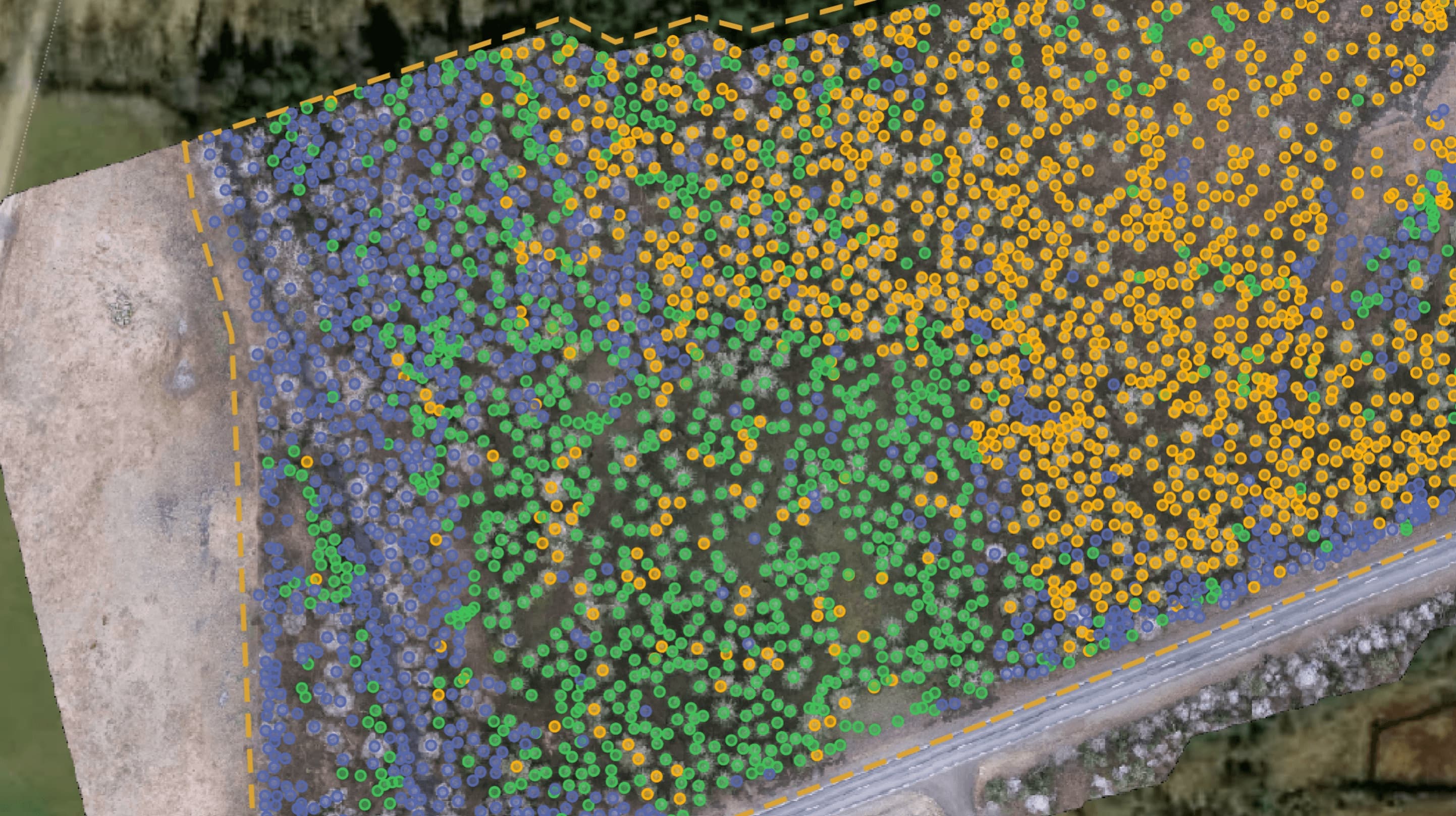
Traditional forest inventory is time-consuming and costly, and often gives an incomplete picture of large forest areas. Relying on manual measurements and sampling means data quickly becomes out of date, making it hard to take strategic decisions on matters such as harvesting and forest health. This leads to inefficiency, lost revenue and increased risk.
The challenges of manual inventory
Manual forest inventory comes with several problems:
- Time-consuming and expensive: Physically surveying large areas requires substantial staff and logistics. Comprehensive updates are often too expensive and are therefore done rarely.
- Sources of error and gaps: Sampling produces estimates, not a complete picture. This can lead to inaccuracies in volume calculations and species identification.
- Slow updates: By the time data has been collected and processed, conditions in the forest may already have changed. This makes rapid response to damage outbreaks difficult.
- Hard to scale: Surveying large forest areas manually is an enormous task, which often forces a trade-off between level of detail and coverage.
Arboair's AI revolution: A new view of your forest
Arboair is reshaping forest inventory by using AI-driven analysis of high-resolution imagery from drones, aircraft and satellites. Our algorithms process image data to deliver insight that was previously unattainable.
- Outstanding accuracy: We move beyond estimates to precise data at tree level. Arboair's AI can identify tree species, measure height and crown, and estimate volume for individual trees across your entire holding. Precision can rise from around 60% with manual methods to over 90% with our AI analysis.
- Drastic efficiency gains: What previously took days or weeks can now be done in minutes. We can cover up to 1,000 hectares per day, compared with roughly 50 hectares manually.
- Actionable insight for smarter decisions: Our platform, ArboPortal, does not just deliver raw data but gives you directly usable information to optimise harvest planning: precisely identify stands for thinning or harvesting based on accurate data on species, volume and health.
- Rapidly assess forest damage: quickly map and quantify damage from insects, storms or fire.
- Monitor forest health: detect early signs of stress or disease at scale.
- Support sustainable forestry: gather detailed data for carbon reporting and biodiversity.
- Significant cost savings: By reducing the need for fieldwork and manual data processing, Arboair lowers inventory costs. The increased accuracy also leads to better resource allocation and faster response to damage.
Arboair's advantage: Technology and expertise
Our strength lies in advanced AI models that are continuously refined and validated. We use state-of-the-art techniques, including synthetic forest data, to train our AI for robustness across different forest types. Arboair offers a scalable solution, whether you need ultra-detailed drone imagery for specific areas or cost-effective satellite data for large-scale monitoring. We also provide essential GIS data layers, including detailed orthophotos and digital elevation models.
The result is a living, dynamic inventory available through ArboPortal, giving forest managers the ability to move from reactive to proactive management, with data they can trust.
Reinvent your forest management with AI
Relying on infrequent, labour-intensive forest inventories is a thing of the past. For large forest owners, AI-driven solutions like Arboair's are the key to reaching new levels of efficiency, accuracy and sustainability. Stop managing with estimates and start optimising with precision.
Want to see the future of forest inventory? Request a demo to discover how Arboair can give you a detailed and actionable picture of your forest assets.